


Outer bands of Hurricane Beryl expected to reach Jamaica before daybreak tomorrow
The outer bands of Hurricane Beryl are expected to reach Jamaica before daybreak tomorrow.
The MET Service says Jamaicans should expect dangerously high water or a combination of dangerously high water and exceptionally high waves.
It says a hurricane warning remains in effect for the island.
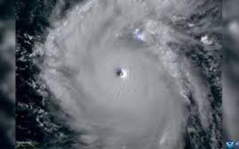
At 4:00 P.M., the eye of Category 4 Hurricane Beryl was located about 205 km south-southeast of the Dominican Republic, or 680 km (east-southeast of Kingston).
Beryl is moving toward the west-northwest near 35 km/h (22 mph) and this general motion should continue through Wednesday, followed by a turn more toward the west on Wednesday night or Thursday.
Maximum sustained winds are near 250 km per hour.
The MET Service says weakening is forecast during the next day or two; however, Beryl is forecast to be at or near major hurricane intensity while it passes near Jamaica on Wednesday and the Cayman Islands on Wednesday night.
The eye of Hurricane Beryl is expected to be south of Haiti this evening before it approaches the southeastern coast of Jamaica on Wednesday morning.
On the current forecast track, the centre of the hurricane is expected to move very near or over the island’s southern coastline during Wednesday afternoon.
Rainfall from the outer bands of Beryl will however, start affecting Jamaica very early on Wednesday morning, beginning with sections of eastern and north-central parishes.
These will gradually spread across the island as the centre moves closer to the coast and will be accompanied by periods of strong winds, gradually increasing to hurricane force during the morning.
Dangerous storm surges and battering waves will also be generated mainly along coastal areas of eastern and north central parishes.
The MET Service continues to monitor the progress of Hurricane Beryl.
The next bulletin on this system will be issued at 8 this evening.
0 Comments